
")

FOREST FIRES: Drones and AI to make fires more controllable
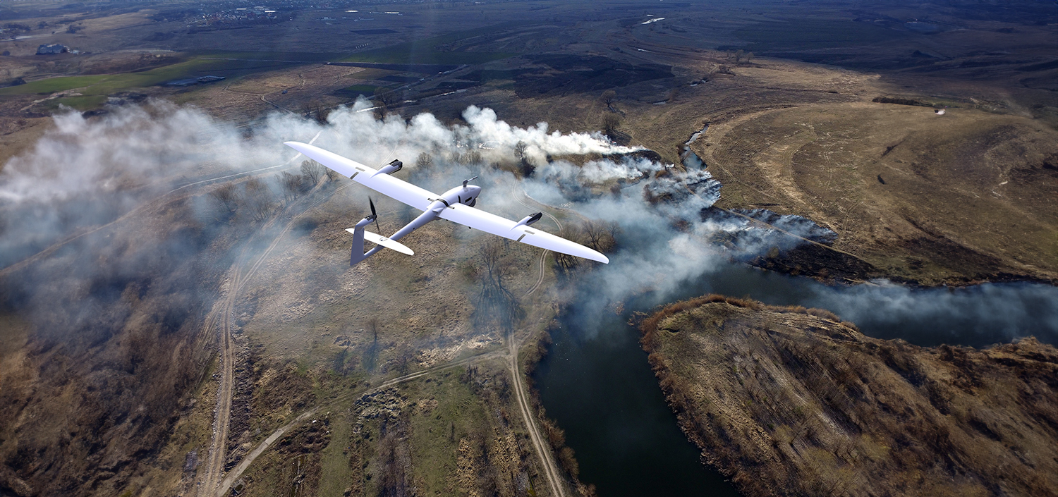
Drones enable flexible and comprehensive monitoring of forest areas.
© Quantum Systems GmbH
Forests in Central Europe are subject to change, and the risk of forest fires is increasing, particularly in coniferous forests. Not only does such a fire lead to a loss of habitat and pose a threat to animal and human life, it also impairs the forest's function as a CO2 reservoir. When a tree burns, the CO2 stored in it is released back into the atmosphere. Consequently, there are numerous compelling reasons to prevent forest fires or at least fight them at an early stage. Tobias Heuser, head of the project "AI-based forest monitoring - artificial intelligence for the early detection of forest fire events" (KIWA for short), explains in an interview how modern technology can support this.
Mr. Heuser, there are already various methods for forest monitoring. How did you come up with the idea of developing a new system?
Existing methods for forest fire monitoring work with local sensors or satellite images. Providing data via satellites is expensive, usually takes place with a time delay and the resolution of the images is often so low that small fires cannot be detected. But that's exactly the point: the smaller a fire is, the easier it is to control. We want to make it possible to monitor a region comprehensively with a technology that can be used flexibly. This means that it can be transported to a location whenever it is needed. Tobias Heuser heads the KIWA joint project © private
Can you describe how the AI-based forest monitoring works?
We use a three-stage process. In the first phase, we focus on creating a map of particularly endangered regions. To do this, we analyze weather, climate and satellite data. Based on these evaluations, we want to make recommendations as to which local authorities should consider stepping up forest fire monitoring. The aim of this map is to target the use of technology where it is most urgently needed.
Why do you rely on drones?
Drones - equipped with thermal imaging cameras, among other things - allow us the aforementioned flexible, comprehensive surveillance of an entire region. They are easy to use and can take off and land vertically. This is a great advantage, especially in wooded areas where there is not much space. In addition, unlike airplanes, which are also used for early forest fire detection, drones do not emit CO2. The drones should also be able to use data from our data platform to decide for themselves when forest observation is necessary and take off accordingly.
And what contribution does artificial intelligence make?
Artificial intelligence analyzes the data collected by drones to identify patterns and trends that could indicate a potential forest fire risk or event. It is crucial that this information is immediately forwarded to the relevant parties, such as fire control centers. This requires a suitable digital infrastructure, which we call an Open Urban Data Platform.
Data from various sources is combined and analyzed on our high-performance and reliable [ui!] UrbanPulse platform. Algorithms are used to derive recommendations for action, which are displayed to the control centers on a dashboard. This digital infrastructure allows us to create an up-to-date picture of the situation at local authority level. The dashboard forms the third stage of AI-based forest monitoring.
Can people be left out of this process?
No, people remain the decision-makers. What we want is the best possible support for people. The more we automate the process of forest monitoring, the better we succeed. If the system generates an alarm, it still needs a human to verify it. If he does this, the system can make an impromptu recommendation on what to do. This enables authorities to deploy resources in a more targeted manner and take timely action to prevent the outbreak of a forest or wildfire as effectively as possible or to control the fire.
The project started at the beginning of 2023. What is the current status?
We have trained the first AI models that automatically detect smoke and fire. This year, we will put the AI into operation on the drone's hardware and carry out the first test flights. We are very optimistic that we will be able to launch a demonstrator on the market by the end of the project in December 2025. Until then, local authorities have the opportunity to apply as a location for our real-world laboratory. Information can be found on our project website www.kiwa-projekt.de.
© [ui!] Urban Mobility Innovations (B2M Software GmbH)
About the project
KIWA is funded by the Federal Ministry for the Environment, Nature Conservation, Nuclear Safety and Consumer Protection (BMUV) with around 1.8 million euros under the "AI Lighthouses for the Environment, Climate, Nature and Resources" funding program. The consortium consists of four active project partners: [ui!] Urban Mobility Innovations (B2M Software GmbH) as consortium leader is an expert in data analysis, artificial intelligence and open urban data platforms and focuses on innovative, data-driven solutions for local authorities. Quantum-Systems GmbH is an innovative company that develops and produces state-of-the-art unmanned aerial systems to provide customers in various industries worldwide with more efficient solutions to their challenges. In addition, the Institute for Applied Informatics (IAI) - Deggendorf Institute of Technology and the University of Bayreuth with the Chair of Biogeography and the Chair of Disturbance Ecology are providing scientific support for the implementation of the project and supplying the necessary findings from basic research.
Those interested can contact Tobias Heuser:
 © BMUV


